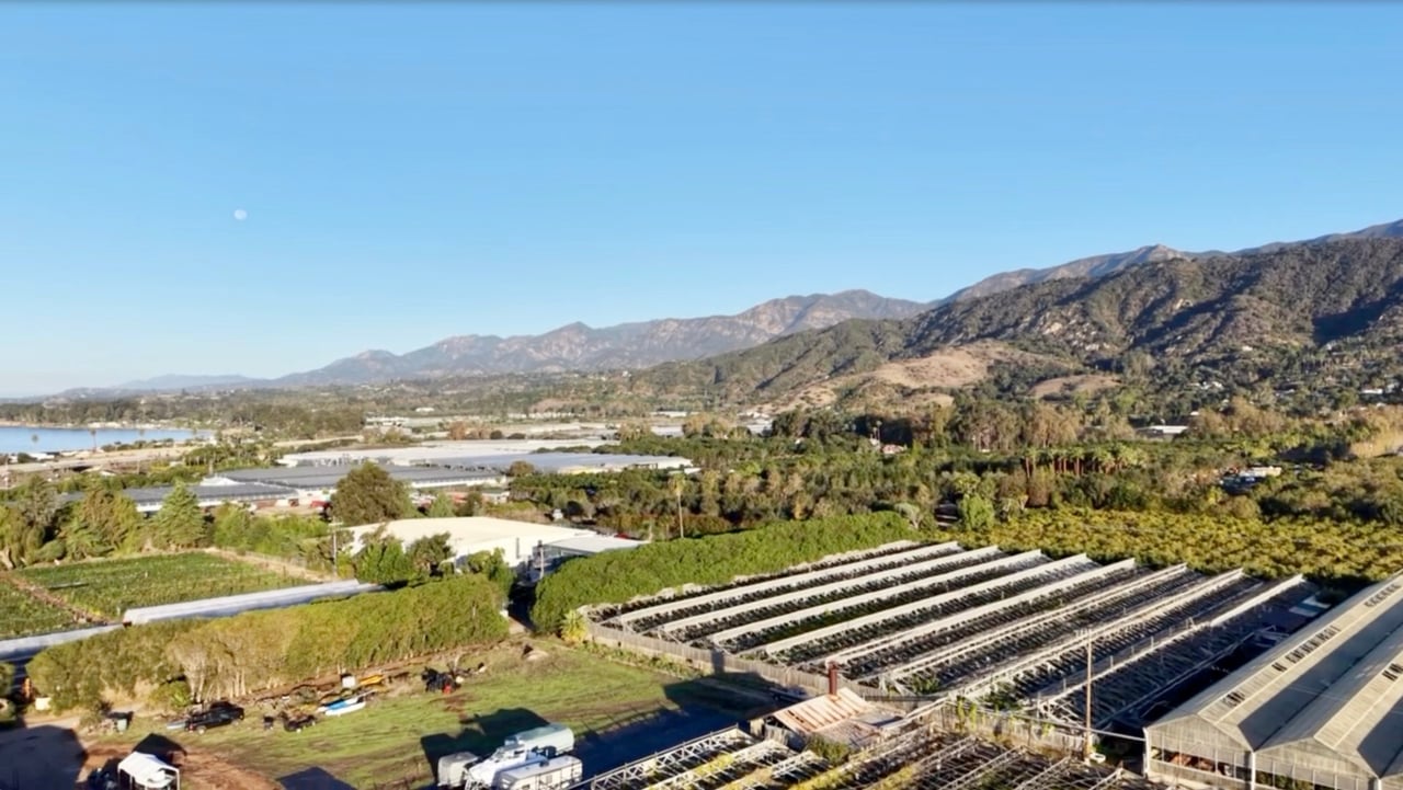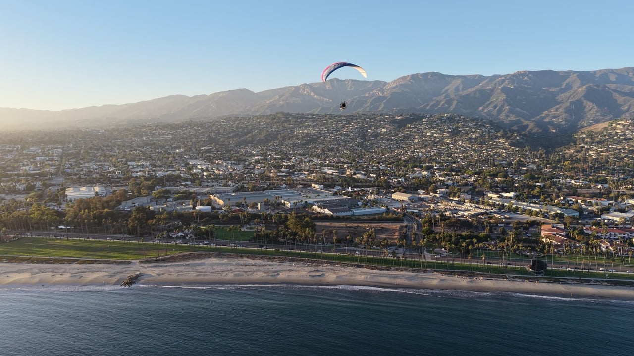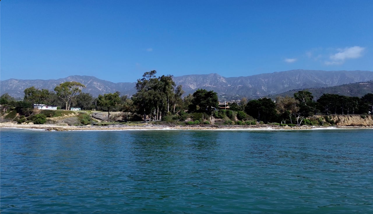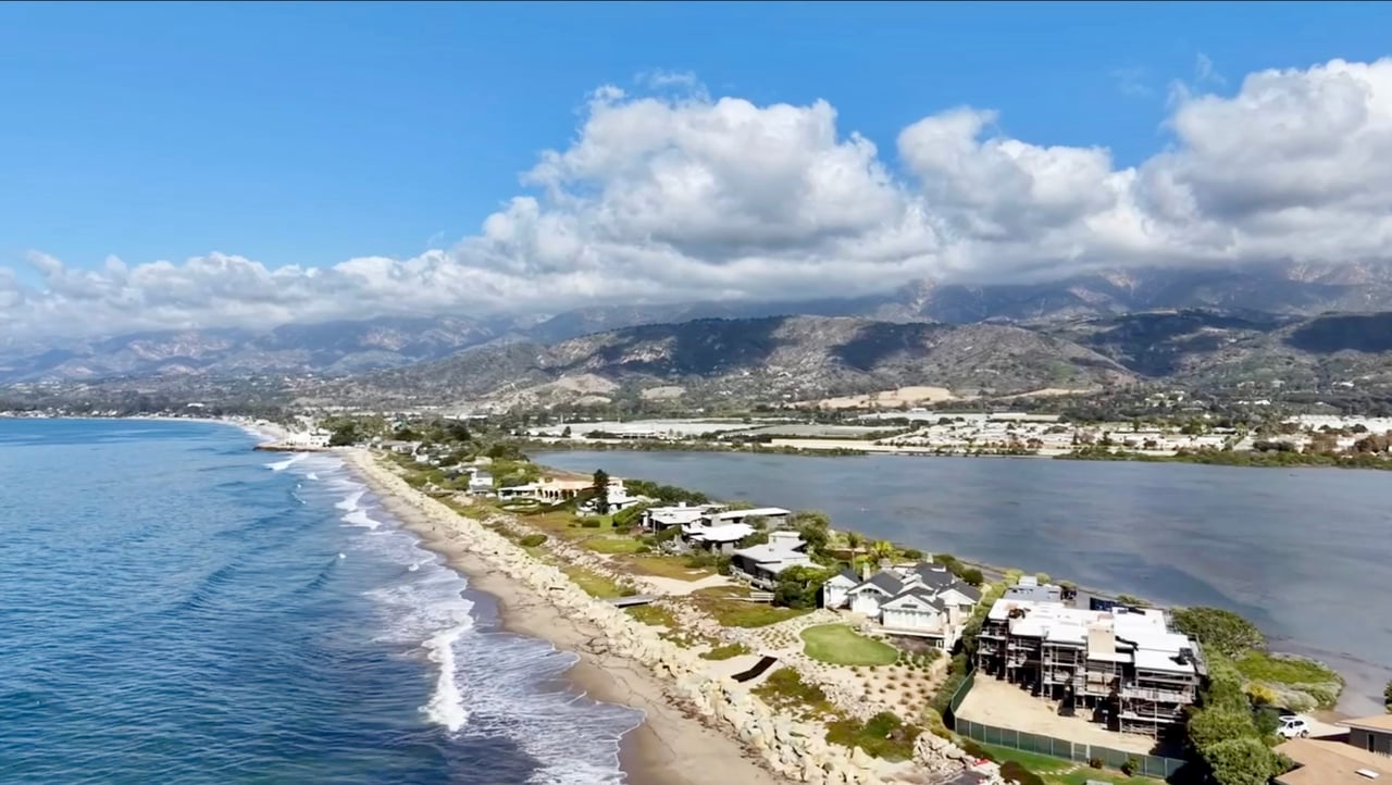
With the higher tides along the coast and all the news about the Kelvin wave, you may be wondering how it's affecting Santa Barbara. The tides are higher. So I went out with my drone to document what it looks like along our coast, and I'm sharing it with you here.
Drone tour: the Santa Barbara coastline at high tide
I filmed on Tuesday, October 27, 2026, starting at the Santa Barbara waterfront and working my way down the coast to Carpinteria.
Santa Barbara waterfront
Butterfly Beach, in front of the Biltmore and Coral Casino
Miramar Beach, in front of the Rosewood Miramar
Fernald Point
I skipped Summerland, where only a handful of homes sit above the bluffs.
Padaro Lane
Sand Point Road, next to the Carpinteria Salt Marsh, and Avenue del Mar
Watch: Avenue del Mar at high tide
Watch: The Carpinteria Salt Marsh at high tide
Carpinteria Beach
Fortunately, Santa Barbara was not impacted nearly as seriously as other areas along the coast. The one place I saw water come over a road was near Sand Point Road, where the marsh came onto the road. A salt marsh is meant to fill with the tide and hold water during storms, and UC Davis monitors its water levels in real time.
That said, Santa Barbara isn't immune to big storms. In the winter of 1983, during a strong El Niño, a major storm damaged parts of our coastline, including Stearns Wharf and the harbor, and the wharf was closed for about three months for repairs. Our coastline tends to be more sheltered than many in Southern California, but it's still smart to know your flood zone and be prepared.
I'll keep checking the coast through king tide season, usually November through January, and share what I see in The Weekly Read.
Insurance rules, rates and flood maps change often. Please confirm with your insurance agent, your city or the County, or a qualified professional before relying on this information.
Last updated: October 28, 2026
Key takeaways
- Kelvin wave: A slow bulge of warm ocean water tied to El Niño that can raise sea level along the coast by about 6 to 12 inches for months.
- New flood maps: Updated FEMA flood maps took effect in Santa Barbara County and the City of Santa Barbara on June 10, 2026.
- Insurance: Standard homeowners policies generally don’t cover flood damage. Flood policies through the National Flood Insurance Program have a 30-day waiting period.
- FAIR Plan: An average 29.1% rate increase applies at renewals on or after October 15, 2026.
What is a Kelvin wave?
A Kelvin wave isn’t a breaking wave or a tsunami. It’s a slow bulge of warm water that forms in the western Pacific, crosses the equator over six to eight weeks, and then travels up and down the coast of the Americas. It’s connected to El Niño.
According to researchers quoted by National Geographic, the wave can raise sea level along California by about 6 to 12 inches when it arrives, and the higher water can last for months. They note that even 2 to 4 inches can roughly double the risk of coastal flooding in low-lying areas.
What’s happening in Santa Barbara
KEYT reported on October 12, 2026 that high tides in Santa Barbara came in more than a foot above predictions over the prior two days. Boats and docks in the harbor sat higher than usual, and the Santa Barbara Yacht Club’s commodore said his understanding is that there won’t be a sand berm this year. KEYT also reported that the effect could continue through the winter and spring, especially when high tides, big swells and storms line up.
Why Santa Barbara’s coast is more sheltered, and where it isn’t
Most of the California coast faces west, into the open Pacific. Santa Barbara is different: from Point Conception to Ventura, the coastline runs east to west and faces south. Point Conception blocks much of the north and northwest swell, and the Channel Islands block a large share of the west and south swell. The U.S. Geological Survey has found that wave heights in this sheltered area are less than half of those in the open ocean.
Other Southern California beaches don’t get the same protection. The coast from Ventura to Port Hueneme can take west swell head-on, beaches from Long Beach to Newport are open to swell from both the west and the south, and San Diego is the most exposed to south swell.
Where Santa Barbara can still be vulnerable:
- Storms that line up with high tides. The islands reduce waves, but they don’t lower the tide. In 1983, some of the worst local damage came when a storm surge arrived on a full-moon high tide.
- Swell from just the right angle. Swell from slightly east of south can reach Santa Barbara directly. It’s rare, but it happens.
- The east end of the channel. South swell that passes Anacapa Island usually reaches the coast near Ventura and Rincon Point.
- Low areas next to the salt marsh. These fill first at high tide, as Sand Point Road showed this week.
Check your flood zone
New FEMA Flood Insurance Rate Maps took effect on June 10, 2026. Some properties were added to flood zones and some had their requirements reduced. Look up your address:
- City of Santa Barbara: FEMA flood map update and interactive map
- Santa Barbara County: FEMA remapping (Montecito, Summerland, Hope Ranch and other unincorporated areas)
- City of Santa Barbara: sea level rise hazard maps
- FEMA Flood Map Service Center
If your home is in a FEMA Special Flood Hazard Area and you have a federally backed mortgage, your lender will require flood insurance.
Types of home insurance to review
Policy | What it generally covers | What to know |
Homeowners (HO-3) | The house, belongings, liability and many types of damage | Generally doesn’t cover flood or earthquake |
Flood insurance (NFIP) | Flood damage to the building (up to $250,000) and contents (up to $100,000) | 30-day waiting period for new policies; available whether or not you’re in a mapped flood zone |
Private flood insurance | Flood damage, sometimes with higher limits than NFIP | Terms and waiting periods vary by insurer |
California FAIR Plan | Fire, lightning, internal explosion and smoke | Doesn’t cover liability, theft or water damage |
Difference in Conditions (DIC) | Fills gaps the FAIR Plan doesn’t cover, such as liability, theft and water damage | A separate policy from a different insurer, with its own premium |
Earthquake | Earthquake damage | A separate policy through the California Earthquake Authority or a private insurer |
Condo (HO-6) | Your unit’s interior, belongings and liability | Check what your HOA’s master policy covers |
Renters (HO-4) | Your belongings and liability | The landlord’s policy doesn’t cover your belongings |
The FAIR Plan rate increase
On April 6, 2026, the California Department of Insurance approved an average 29.1% rate increase for the FAIR Plan’s dwelling fire policies. The FAIR Plan had requested 35.6%. The new rates apply at the first renewal on or after October 15, 2026.
It’s a statewide average, so not every policy will go up by that amount. The wildfire portion of the premium drives most of the change, so homes in higher-risk areas may see more, and some homes may see less or a decrease. Discounts of up to 16.4% off the wildfire portion are available for qualifying home hardening on policies effective on or after November 15, 2025. Ask your insurance agent which ones apply to your home.
How to prepare your home: a checklist
Document everything
- Walk through your home and video every room, including closets, drawers, the garage and the outside of the house. Say what things are as you film.
- Take photos of valuables, serial numbers, artwork and jewelry.
- Save receipts, appraisals and your insurance policies.
- Store copies in the cloud or somewhere off-site, not just on a phone or computer at home.
Review your insurance
- Read your declarations page and check your coverage limits, deductibles and what’s excluded.
- Ask your agent whether you need flood insurance, even if you’re outside a mapped flood zone.
- Remember the 30-day waiting period on new NFIP flood policies, so don’t wait for a storm.
- Make sure your coverage would pay to rebuild at today’s construction costs.
- If you’re on the FAIR Plan, check whether you also have a DIC policy and look at your renewal date.
Get the house ready
- Clean gutters, downspouts and drains, and make sure water flows away from the house.
- Move valuables, important papers and electronics off the floor in basements, garages and ground-floor rooms.
- Check with the city or County for sandbag locations before you need them.
- Know how to shut off your gas, water and electricity.
Stay informed
- Sign up for Santa Barbara County emergency alerts at ReadySBC.org.
- Check National Weather Service forecasts and coastal flood advisories before high tides and storms.
- Avoid beaches, piers and low-lying coastal roads during high tides and big swells.
If you’re buying or selling
Buying: Look up the flood zone before you make an offer, and get insurance quotes during your contingency period, including flood insurance if it applies. Insurance costs can affect your monthly payment and your loan approval.
Selling: Have your current insurance information and any flood zone documents ready for buyers. California sellers are required to disclose whether a property is in a FEMA special flood hazard area, and the standard seller disclosure form asks about any known past flooding or drainage problems.
Frequently asked questions
Does homeowners insurance cover flooding in California?
Standard homeowners policies generally don’t cover flood damage. Flood coverage is a separate policy through the National Flood Insurance Program or a private insurer.
How long does it take for flood insurance to start?
New NFIP flood policies generally have a 30-day waiting period before coverage begins.
When does the FAIR Plan rate increase take effect?
The approved average 29.1% increase applies at the first renewal on or after October 15, 2026.
How do I find out if my Santa Barbara home is in a flood zone?
Use the City of Santa Barbara’s interactive flood hazard map for homes in the city, the County’s FEMA remapping page for unincorporated areas, or the FEMA Flood Map Service Center.
How long will the Kelvin wave raise sea levels?
Researchers say the higher water levels can last for months, and local reporting says the effect could continue through the winter and spring.
Sources
- USGS: Variability of the Southern California wave climate
- O’Reilly, Guza and Seymour: Wave sheltering in the Santa Barbara Channel (1999)
- Santa Barbara Bucket Brigade: 1983 Winter Storms
- California Civil Code 1103: natural hazard disclosure
- KEYT: A Kelvin wave surge brings tide levels up (Oct. 12, 2026)
- National Geographic: A Kelvin wave is pulsing up the West Coast
- Santa Barbara Independent: New FEMA flood maps take effect
- California FAIR Plan
- FloodSmart.gov (National Flood Insurance Program)
Questions about a property?
Call me at 805.637.4400. For the latest sales every week, read The Weekly Read.
Please note: Insurance coverage, rates, flood maps and regulations change often, and every policy is different. This post is a general summary as of October 2026, not insurance or legal advice. Before relying on this information, check with your insurance agent, the City of Santa Barbara, Santa Barbara County, FEMA or another qualified professional.
Kathy Henry is a Broker Associate with Sotheby’s International Realty in Montecito and has worked in Santa Barbara real estate for 22 years.
Kathy Henry · Broker Associate
Sotheby's International Realty · Montecito
805.637.4400 · kathyhenry.net
CA DRE #01403548